We woke up in the morning with a plan.
Glacier National Park, like Rocky Mountain, basically has two sides. In this case, there is a “Road to the Sun” that weaves through the mountains and connects and East with the West. Also similarly, they run a shuttle system which will take you all along this main road to various trailheads.
Cool. So we enter the park in the West and signup for our campsite for 2 nights. Our plan is to get up early and stop in at the visitor’s center when it opens. Then catch the earliest shuttle we can, take it over to the East Side, and spend the day hiking over there. We’d return back to the West for the night, hike the next morning, and then drive back across ourselves on our way to Canada! Sounds pretty good right??
We get to the visitor’s center and are greeted by Ranger Doug. No idea what his real name was, but he is the exact doppelganger of an old coworker of mine… Appearance, demeanor, personality, everything. Doug was really nice and helpful. Showed us a bunch of favorite hikes in different areas of the park.
He also ruined everything.
Oh I’m sorry, the shuttle system stopped running over Labor Day weekend… Oh I’m sorry, only vehicles shorter than 21’ can take the “Road to the Sun” across.
Awesome. New Plan.
We go back to the campground and convince the ranger there that we are idiots and need to be released from our 2nd night. He says we may be able to show our ticket to the manager of one of the other campgrounds and get in there for the night. Sweet.
So now we have to do a hike here on the West side because we won’t be coming back this way. But first we stopped to check out Lake McDonald and its early morning mist…
We then head a little ways up the Sun Road to our first hike of the day. Ranger Doug had suggested a nice 4 mile round trip hike up to Avalanche Lake. Not exactly a tough hike, but we were already thinking that we were going to be doing two hikes that day… This trail was really cool though. It started out winding through the beginning of the Northwest Rainforest. Gigantic trees, 4 to 7 feet in diameter!! Cedars, Oaks, etc. I’m usually the tall one!!
The trail takes us by a cool little gorge…
And then we are hiking through thick groves of cedars!! It was really cool to see so many trees packed together. There was barely any undergrowth since little sunlight gets through the dense canopy. Most of the ground was covered in an extremely bright green moss…
We made it to Avalanche Lake and were greeted by some great views. A good size lake surrounded by steep cliffs on three sides. It looked like the sun had only just risen above the range across the lake. Probably would make for a great sunrise if you could make it there early enough…
Then it was back down through the forest to the RV…
And we were on our way around the park to the East side…
We arrived at the Two Medicine area, found a campsite, convinced the Ranger in charge to let us stay for no extra charge, and started off on hike number two for the day. All by 2pm!! For this area, Ranger Doug had suggested an 11 mile hike up to Cobalt Lake. He proceeded to mention that the was a suspension bridge along the way, as well as some waterfalls, great views, and a lake that had a nice shade of blue… But he had Megs at suspension bridge.
So we set off and the first mile or so is nice, pretty flat, jaunt past some marshes and through meadows…
We then come across a trail spur that Ranger Doug had nonchalantly mentioned we might as well along our way. It was only .7 miles so we figured, how bad could it be?? Bad. It was .7 miles alright, straight up about 5 or 6 steep switchbacks!!! A nice view at the top and all, but phew!
So an extra 1.4 miles later we are back on the original trail and start off again for Cobalt Lake. Soon after, we reach the bridge!!
Very cool. And scary…
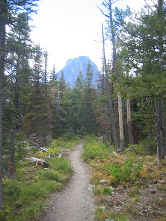
Continuing on, the trail alternates between taking us through sloping meadows and forest at the base of the valley we are hiking. I later decided that these patches of open meadows between forest must be the site of large avalanches from the cliffs above. No idea if that’s actually true, but its probably close…
At the 3.5 mile mark we reached Roosevelt Falls. It had been a pretty easy hike so far, but the falls signaled that the trail was about to get a whole lot steeper…
What we didn’t know was that from this point it was basically a constant steep slope, full of switchbacks, for the entire next 2 miles all the way to the top. The last half mile or so we could see the sheer cliff that marked the top of the mountain range looming right ahead of us and thought for sure that we had missed the lake. It couldn’t be so high up, so close to the continental divide. Oh we were incorrect…
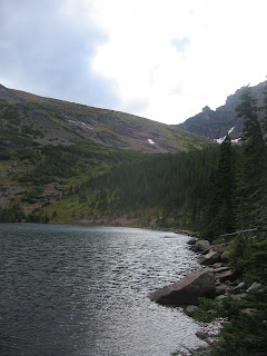
The lake turns out to be right at the base of those cliffs. We figured Ranger Doug might have mentioned that shouldn’t worry if it feels like you are going to walk right over the top of the mountain… And not really all that different of a lake color either. I suppose it was pretty dark blue. Perhaps even cobalt…
The continental divide was only another mile and a half up. We both secretly contemplated wanting to check it out. Get to the top and look out over mountains as far as the eye could see. But we were pretty tired from the last 2 miles of climbing. And it was already 5pm, we’d start losing light around 7 or 8. So back down we go, past the falls, across the bridge, over the river, and through the woods, to grandma Rocky we go…
Our final tally for the day? 16.4 miles!! Exhausted doesn’t even cover it… And for some reason the top of my right ankle started bothering me along the way too. Must have strained the muscle that connects the top of my foot to my lower shin. I guess that’s what I get after a decade of treating my ankles like crap through basketball, soccer, etc. They are basically like rubber now…
Anyway, our meal of choice after our longest day so far?? Grilled cheese!! Yum. This was our first attempt making it in the RV. And it was good. Grilled cheese was definitely one of my go tos back home. Besides Hot Pockets of course… I even started experimenting with adding different meats and whatnot into the sandwiches. Maybe we’ll have to try that out along the way!! Any suggestions??
So after 16.4 miles we headed to bed early, because tomorrow we are going to go see a glacier!!!


I just got caught up on your last 2 weeks. The pictures are great and even make me a little envious. Keep up the great work... Be safe.
ReplyDeleteLove,
The Heppies
ahh! Lake McDonald is beautiful!! That picture could be a post card. Did you run across the suspension bridge shouting "doctor jones! doctor jones!" ?? I feel like you have to do that on all suspension bridges.
ReplyDeleteThese pictures are stunning!! I just made the Lake McDonald one my background on my work computer. - Brit again :)
ReplyDelete